Call to Adventure
Like any office worker faced with a four-day long weekend, I decided it was time to disappear deep into the backcountry. Since my initial weekend plans fell through and my Thursday flight home from the client site was delayed four hours, I used one of my airport lounge passes and spent the time gorging myself on diet coke and figuring out a backpacking trip.
I pieced together a route in Manning Park I thought would work: starting from Hope Pass and connecting to Dewdney Trail. I liked that it was easily accessible, made a perfect loop, and was around 60km, which would justify the effort of a three day hike. Best of all, it didn’t require any reservations for the multiple campsites along the route.
Weirdly nobody seemed to know about this hike. The few reviews I managed to find were not promising: “Overall this loop was less fun than I had imagined” said someone on All Trails, who gave it three stars. Another post on Club Tread from 2003 offered “…tips for anyone who repeats this, although why you would after taking it in vicariously through this report escapes me”.
I ignored these dire warnings. Since I was hiking it solo, all I cared about was avalanche risk and running into other people. Happily these risks both seemed to be zero.
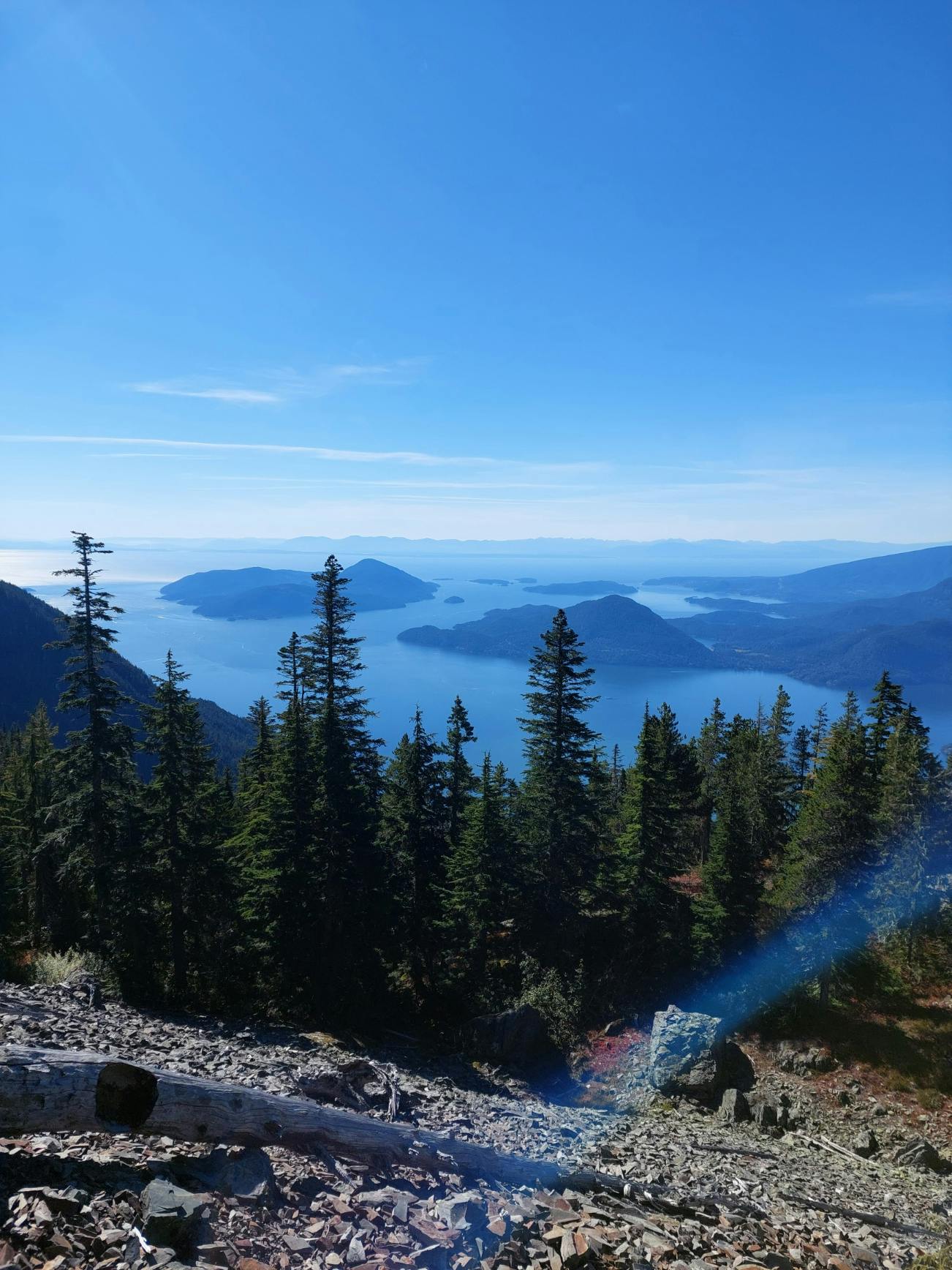
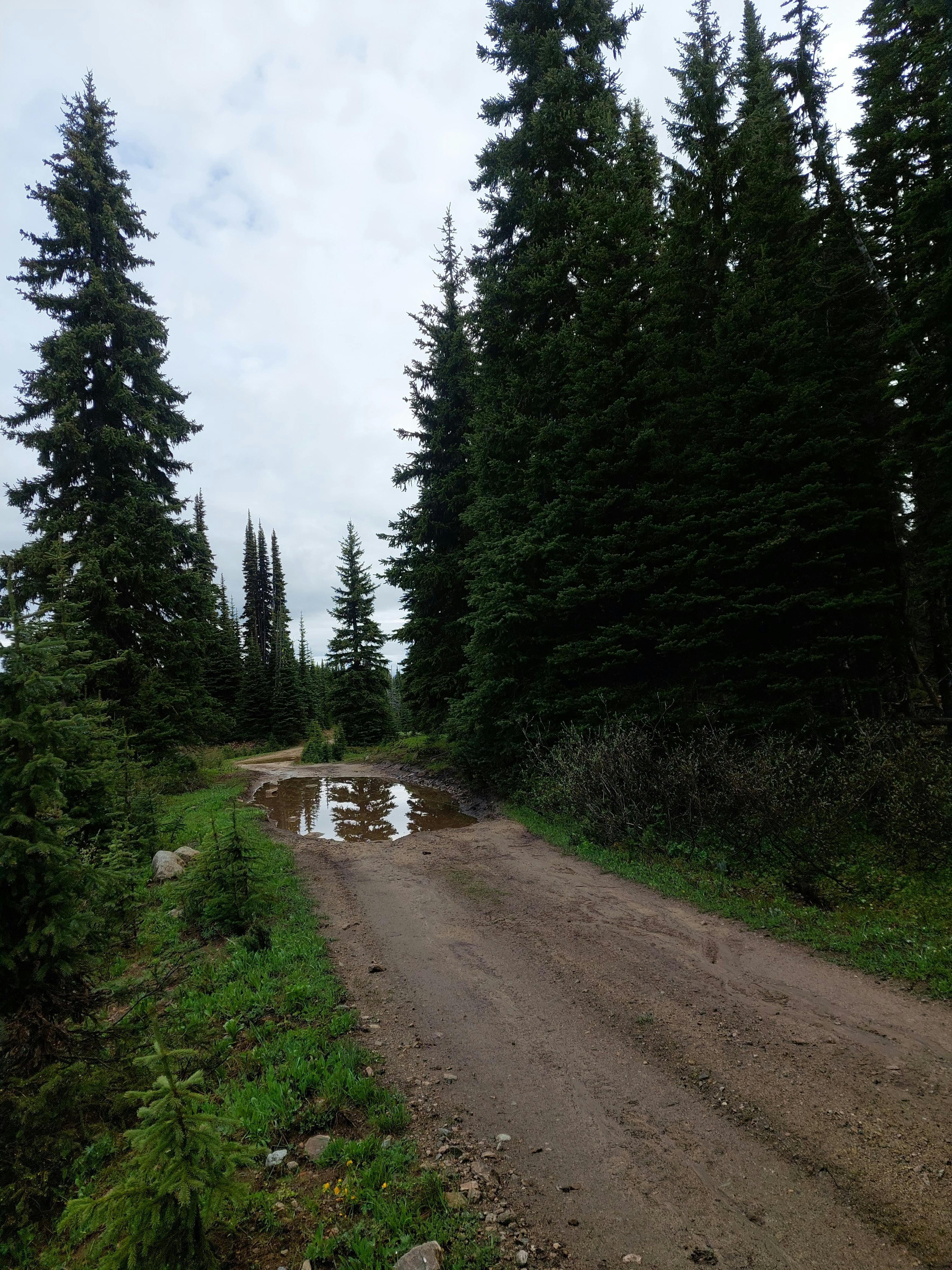
After a late start on Friday, I began my trek from the completely empty Cascade Recreation Site parking lot at a solid alpine start of 11am. The first segment of the hike, Skagit Bluffs, offered the dubious joys of “highway views” and “historic retaining walls”. I pranced along in the dappled sunshine of the forest full of goodwill: the trail was nice! No mud and no fallen trees! What a dream! This joyous state of affairs continued up to Hope Pass, where I crossed a massive log bridge over the Skaist River and headed into the forest.
Hope Pass used to be a wagon route connecting the gold rush towns to the then-capital of BC, New Westminster. One of the reviews said that it felt like a hobbit trail through the woods. I tended to agree, and I thought it might make a good rainy day hike, since there were no views along the trail and it didn't come out of the forest at all.
I made short work of the 12km to Grainger Creek campground. Feeling like a wonderful hiking prodigy, I slung off my backpack to have a late lunch, basking in the sunshine and the good vibes.
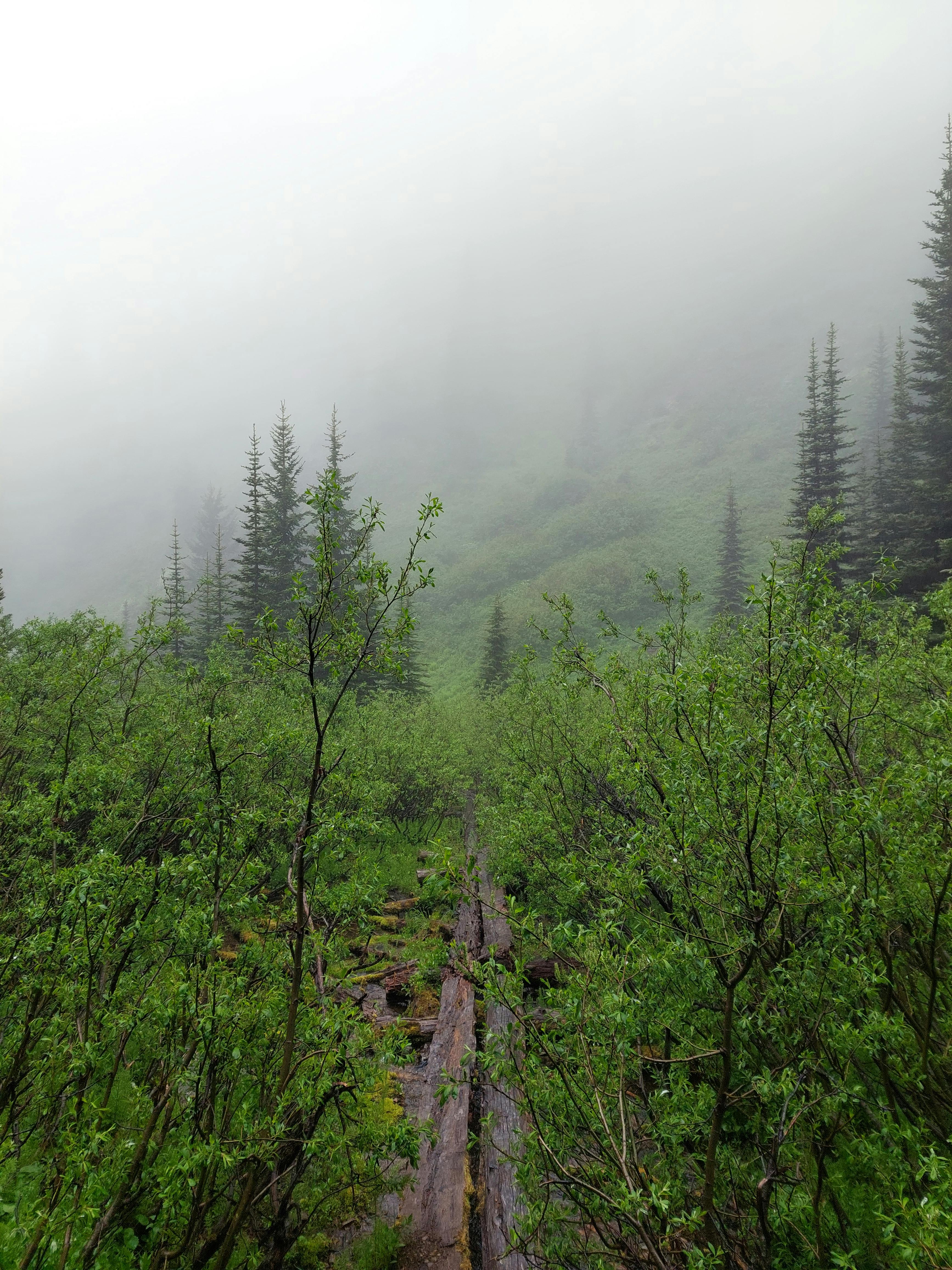
When I set out north, things metaphorically went south. It started raining and I soon discovered I was wrong: it was in fact a heinous rain hike. The thick underbrush of devil's club and silver maple saplings encroaching on the swampy trail left me completely soaked in water, to the point where my shoes squelched with every step, even after the rain eased up.
I also started collecting collecting travel companions. Since nobody had been through the trail before me, I got to run into all the cobwebs face-first, and I also picked up hundreds of dangling inchworms. My decision to put most of the distance and elevation on the first day came back to haunt me as I dragged my damp, unhappy and bug-festooned body the final miserable kilometres to Marmot City camp, rounding out a 26km day.
Take Me Down to Marmot City
Marmot City was a blessed respite from the endless forest trek. A small sub-alpine meadow, it boasted a picturesque creek and a bear cache. However, I did not see any marmots, just approximately one million mosquitoes which all descended on me. I assumed they were starving because nobody hiked this trail.
I quickly scarfed down dinner and set up my tent as rain began to fall again. Since it was only around 7pm I wasn’t sure what I would do — read ebooks? think my thoughts? — but it turns out sleeping for ten hours while camping is a feasible and fun thing to do.
Day Two
My morning breakfast was somewhat tainted by the continuing rain and the bugs, which were determined to die en-mass in my coffee. I’d packed some coarse-ground coffee in teabags, thinking I was so smart, but I didn’t steep it long enough because of the hundreds of suicidal no-see-em flies kept getting into it. More innovation was clearly needed.
I started around 7am and traipsed through Hope Pass and out to Whipsaw Forest Service Road. This part of the trail crossed through some lovely alpine meadows and the rain stopped, so I was in high spirits despite the coffee failure. I reached the FSR junction after crossing the Hope Pass high point marker at 1839m.
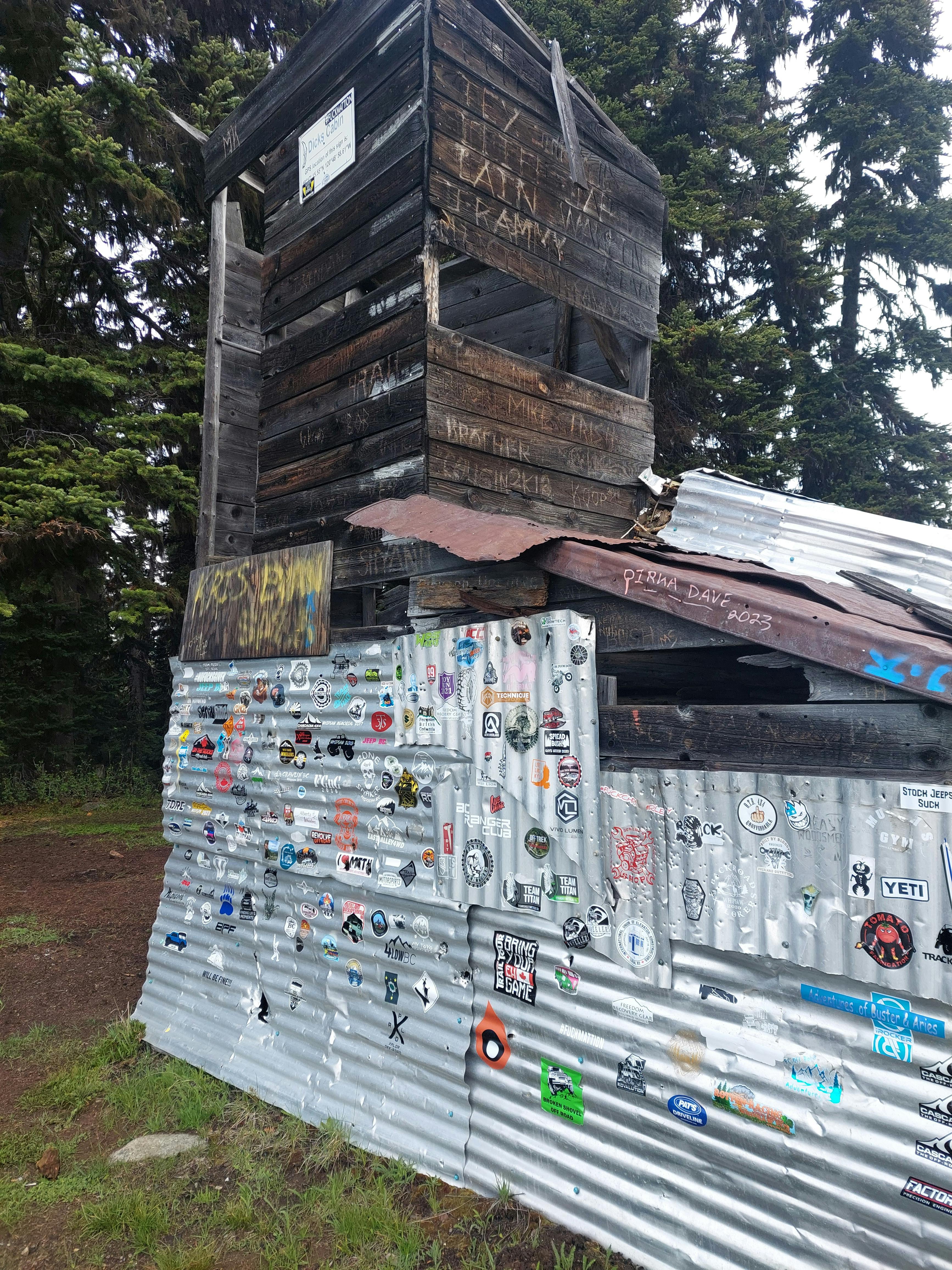
There was a cabin marked on my app called Dick Holding’s Cabin, which I thought was funny enough to be worth taking the extra walk to go see it, so I ditched my pack and trotted up the road. In the end it made me sad more than anything: there was a ton of garbage and empty beer cans littered around the tiny, hovel-ish cabin.
The aluminum siding on the cabin was covered in stickers, which I did think was cool; there were loads of 4x4 club stickers on display, as well as one that I thought was funny, which was a drawing of a middle finger with the caption #unoffendable. Wouldn’t a better hand signal be the thumbs up, since flipping the bird implies a level of offended? Contemplating these mysteries, I returned to the trail and my pack and set off down the FSR.
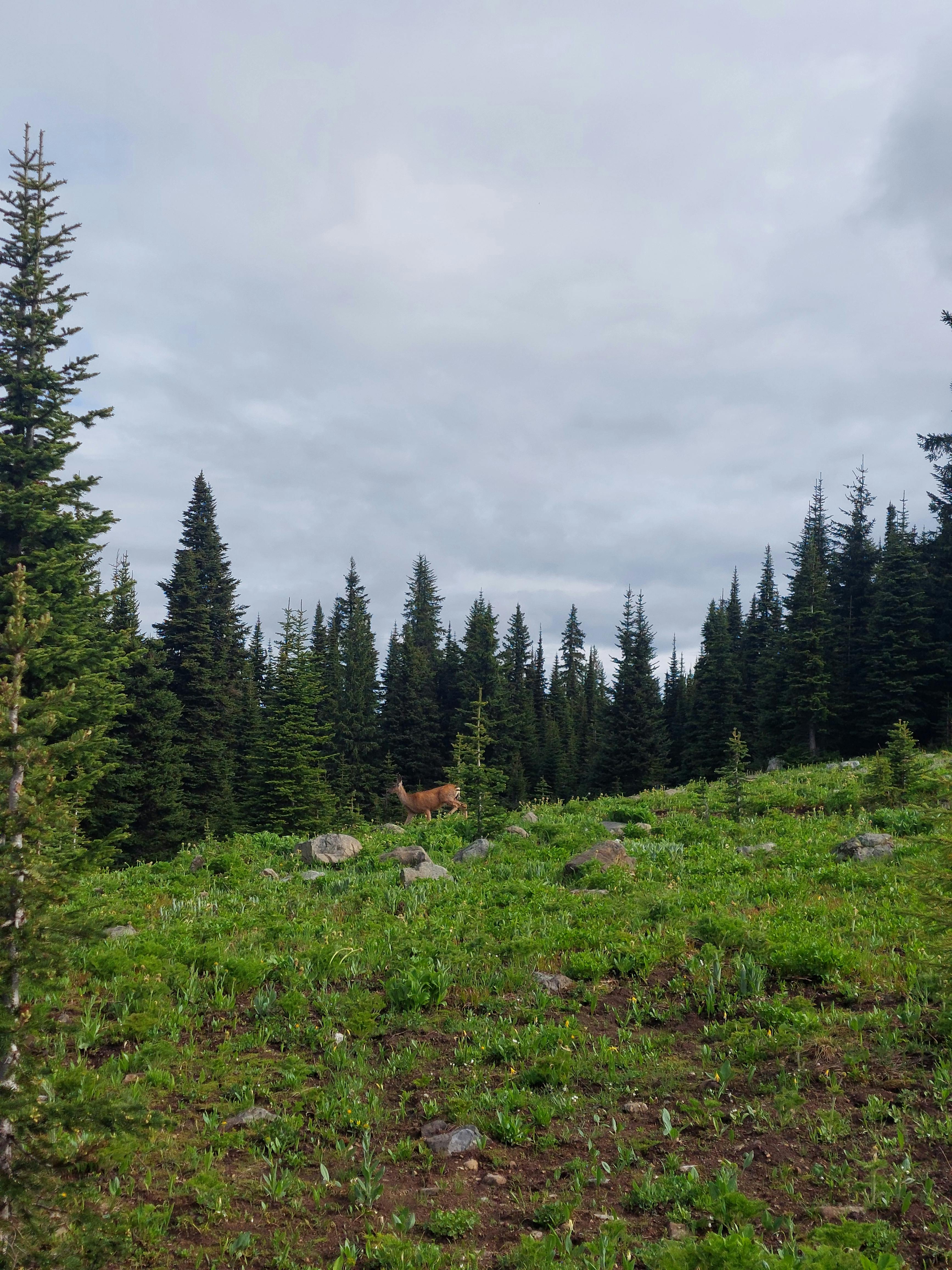
The sandy surface of the Whipsaw FSR was friendly despite the many puddles along the route, and the skies opened up to give me beautiful views of mountains and sub-alpine meadows. I even spotted a couple deer along the way.
The only real downside was the numerous beer cans bleaching out beside the road, regular as breadcrumbs. It makes me feel old and cantankerous, but I don’t get it. You’re in a vehicle, just bring your garbage with you when you go, especially if you’re going up to these beautiful places; otherwise you might as well drive out to the local landfill to smoke darts and crush light beers.
Back on the Trail
After about 8km of FSR plodding I got to the junction with Dewdney Trail at Paddy’s Pond and went right back into the forest single track. At this point I was thinking about forest poems: the woods are lovely, dark and deep. These woods to me seemed young and almost uncertain; thin-trunked firs and hemlocks huddled together, while the pale bleached limbs of dead trees still reached towards the sky. You could see evidence of old forest fires too, from partially burned logs laying beside the trail, some charred marks on the ground still visible. More and more frequently I’d come across a fallen log on the trail that I’d have to go to some effort to climb up or duck under.
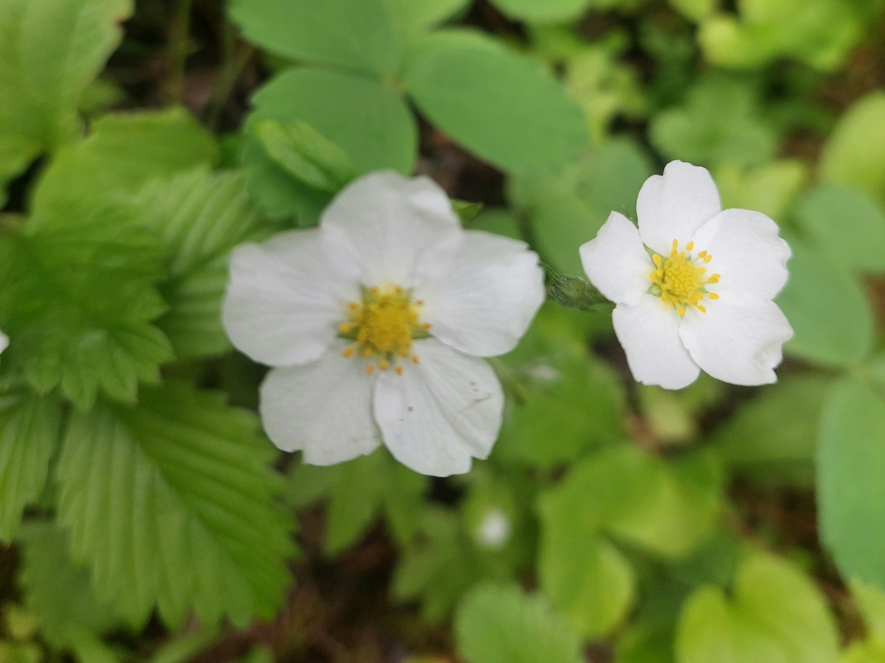
Yet despite this there was a great teeming of plant life attempting to swallow the trail back up. Bright little yellow arnica, purple Artic lupus, and red paintbrush flowers sprang up in the clearings. The understory was thick with glossy green undergrowth and saplings and foliage.
As much as I complain about the rain I love to see the coastal forests like this, exactly as they should be, with the smell of rain and growing things heavy in the air.
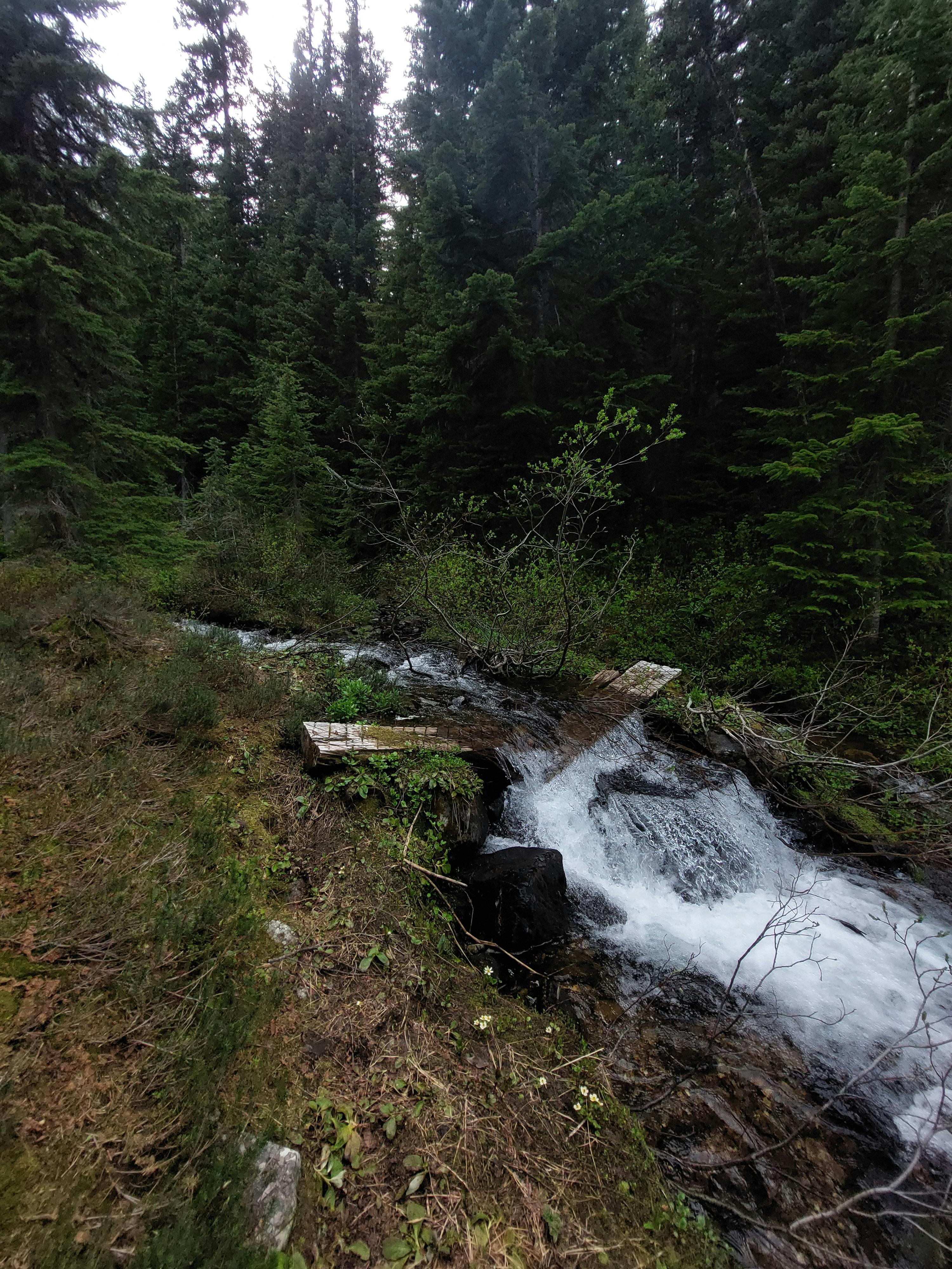
The weather held out, surprisingly, but rain and snowmelt turned segments of the trail into puddles or sometimes creeks. I had a very upsetting crossing of an unnamed branch of Holding Creek where I took off my shoes and waded-thigh deep into the frigid water and sucking mud.
At the Tulameen River crossing I elected to scamper across a slightly sketchy fallen log rather than repeating the experience. Since this is an equestrian-maintained trail I guess this is less of a problem for horses, but as a human being, I don't like cold mud on my feet.
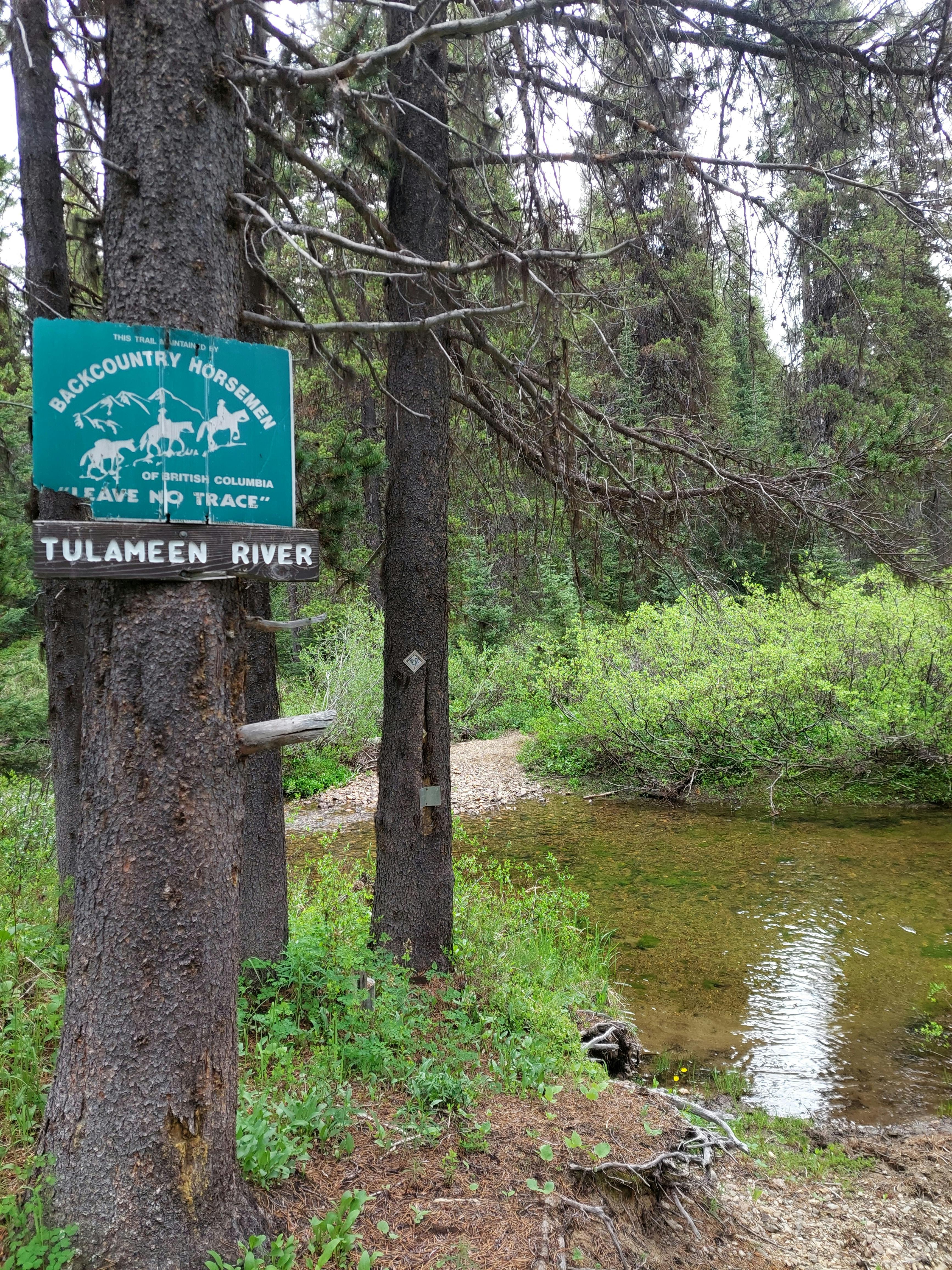
Around noon I came to Salt Lick camp. I couldn’t battle through the thick alder on the riverbanks to get water, so I ended up finding a trail past the camp to the Tulameen River. I’d listened to country music on the drive to the trailhead, because I'd just spent a week in Alberta at the rodeo, and I felt like a cowboy, sitting on the river rocks cooking my meal.
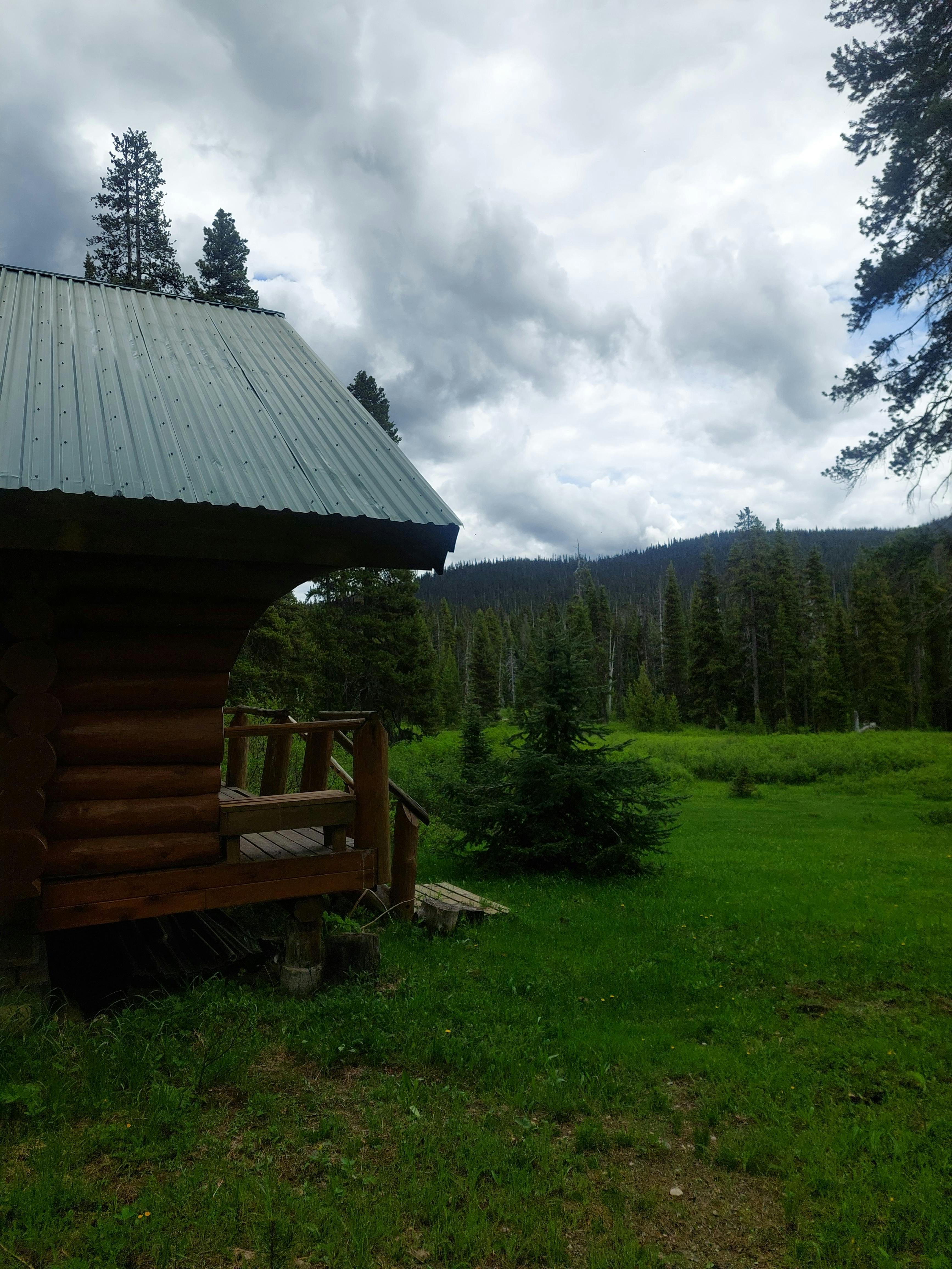
After that it was back on the trail. Along the way I came across the luxurious Tulameen cabin, which had paddocks for horses and a legitimate log cabin with views clear across the meadow to Snazzy and Snass Peaks, but sadly they had the cabin locked. Probably so filthy peasants like me couldn’t get in.
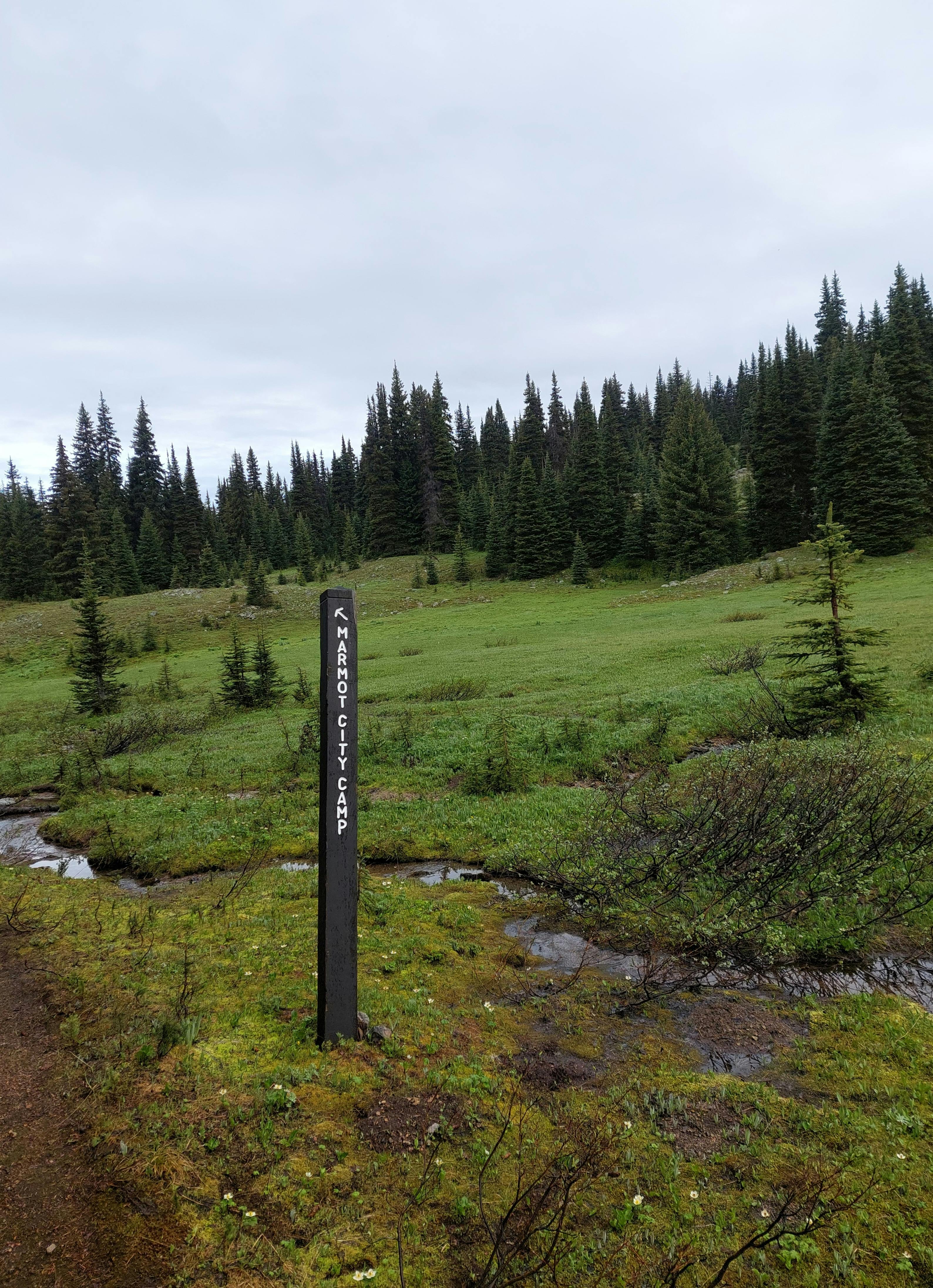
I reached Snass View campsite, which was my original goal, at around 2pm. I decided to have a nap — impossible, with the mosquitoes — and contemplate my next move. According to my map, the big chunk of elevation gain would come on the way to Punchbowl Lake and the pass towards Snass Mountain. I was tempted to try for Snass Mountain tomorrow since it was barely two kilometres extra and would save this loop from the mediocrity of an endless mosquito-infested forest ramble.
Even more promising, the parks map sign had a campsite listed just below the pass, which wasn’t on my map app, but would provide an ideal staging for my attempt on the mountain. From Snass View to the pass was about four kilometres, which I thought would be okay, even though it brought the day’s hiking to just shy of 30km.
Probably because any time I stopped moving about twenty mosquitoes tried to land on me, I didn’t pull out my phone to check the route again before setting off, just started happily traipsing down the beautifully marked Dewdney trail, full of praise towards myself for being so strong and mentally tough to hike almost 30km in a day.
It was here I saw the one and only other person on the trail. It was another solo hiker, a young guy doing the reverse loop of my route, although he’d be heading down to Nicomen Lake rather than Hope Pass. I warned him about the horrid creek crossings and we had a quick chat before going our separate ways. Afterwards I wondered if I should have talked to him more because at the very least we were clearly cut from the same cloth, if not soulmates.
I rambled down the pass until I pulled out my phone to check my GPS position and found to my absolute dismay that I was a kilometre into the wrong direction. The trail I was on, the Dewdney route, would take me to my car, but it was another eight kilometres at least, and I only had legs for the four I was supposed to do to Punchbowl Pass. Besides, I didn’t want to go to my car: I wanted to camp and eat an expensive backpacker meal for dinner and then hike Snass.
So back I went. The guy was long gone, so at least he wasn’t there to bear witness to my shame. At Snass View camp I took the correct turn onto Whatcom trail.
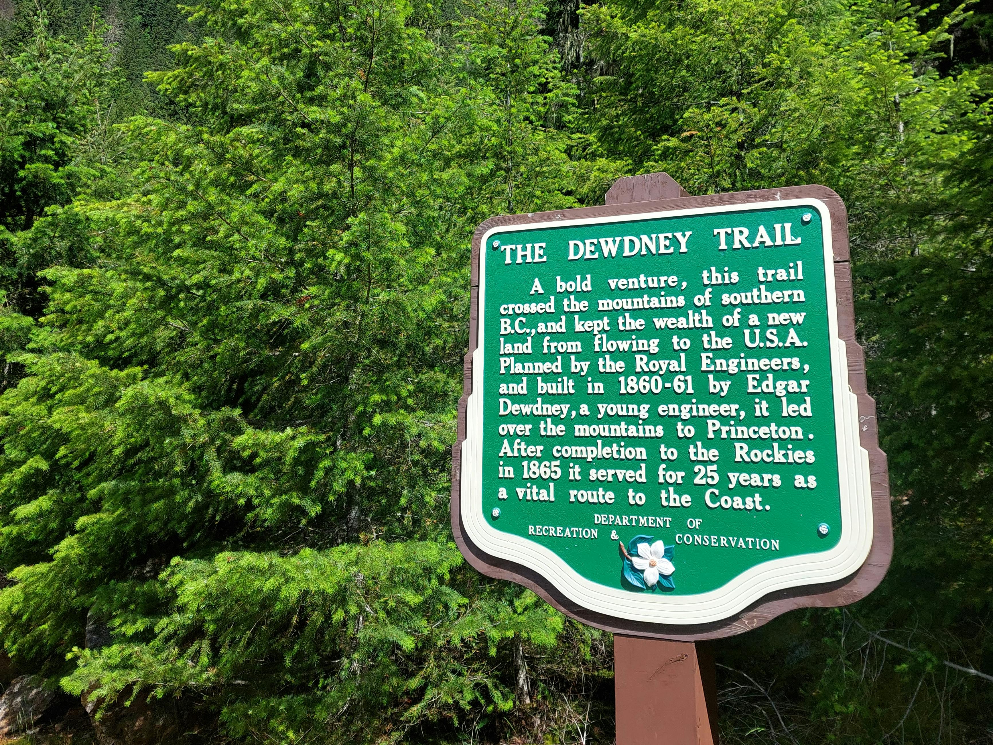
I’d be lying if some of the appeal didn’t come from the name: Snass apparently meant ‘rainmaker’ in the Similkameen language. These trails I was on were all ‘historic’ trails, which were built by various enterprising Hudson’s Bay men with the local Sto:lo and Similkameen guides back in the day.
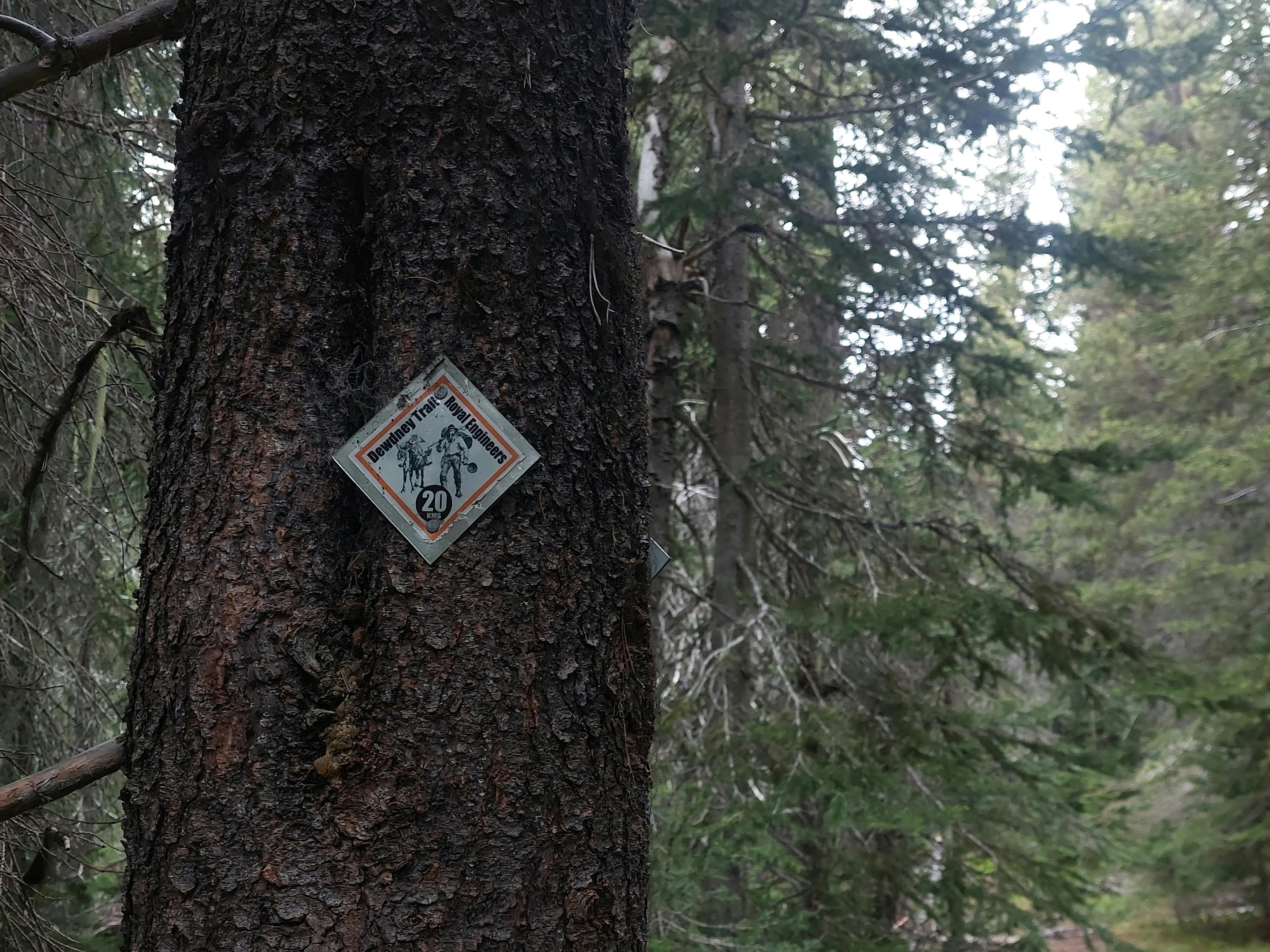
This also answered a question I never knew I had, which was why Dewdney Trunk road was called that; Edgar Dewedney and the Royal Engineers had built the trail. I wonder what went into building trails prior to the invention of GPS and satellite imagery. Enough to get your name everywhere and get elected as an MP, obviously. One of the other trails, Wharburton, was named after Mary Wharburton, who got lost picking berries and almost died along the trail. Truly a feminist icon. I hoped to not repeat her ordeal.
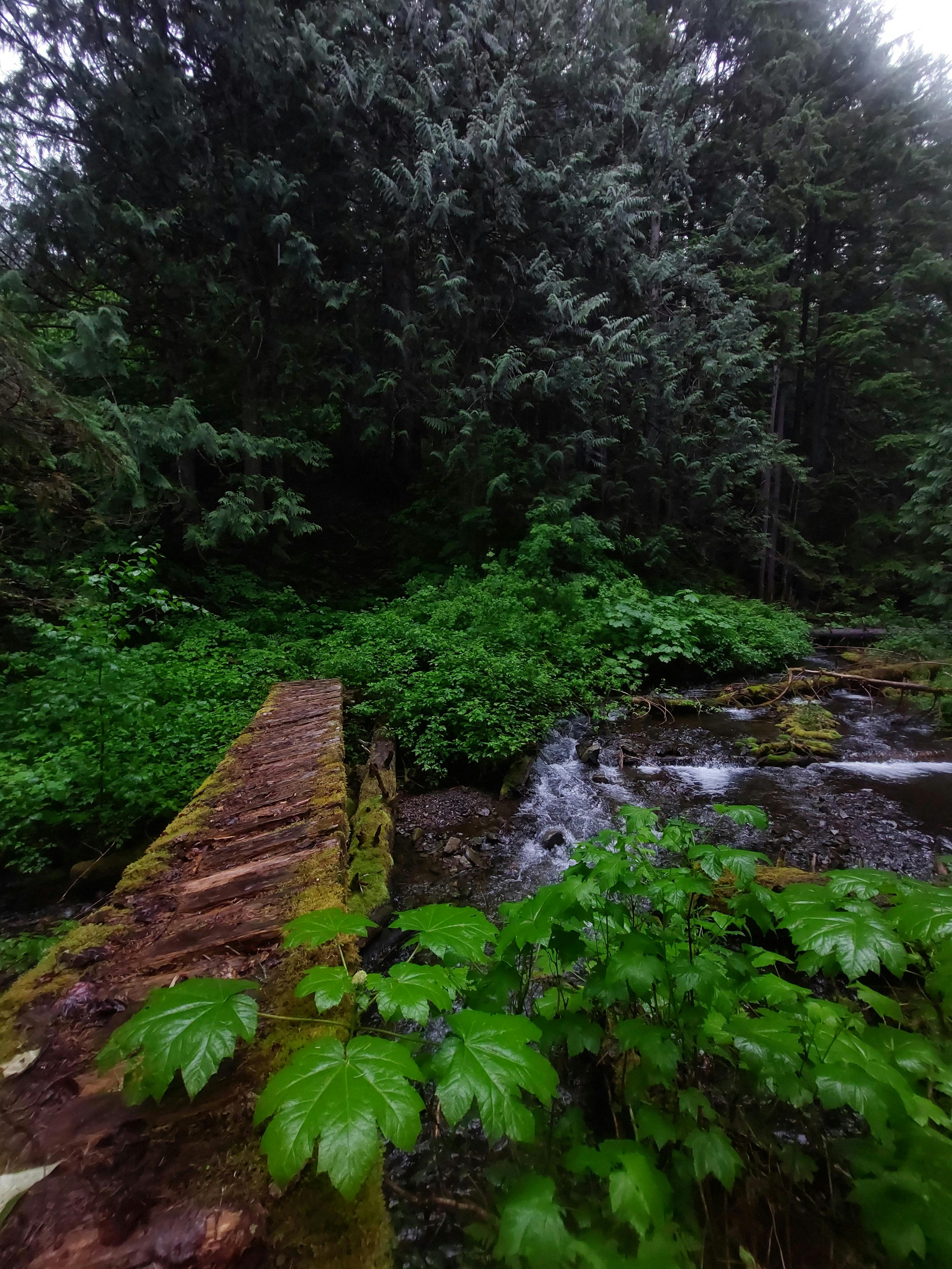
Whatcom trail up to Snass was built with a lot of love. Along multiple stretches of swampy trail there were wooden bridges or stumps to hop along. This seemed very generous and thoughtful after the heinous mud flats and creek crossings I had just endured. Unfortunately many planks were broken, similar to some of the old bridges along Dewdney trail, where the rotted wood had punched through or just plain snapped. At the largest creek crossing the bridge was fully broken in half and submerged under the running water. Here I had to make my biggest jump yet, and luckily cleared it without getting my feet wet or falling into the creek.
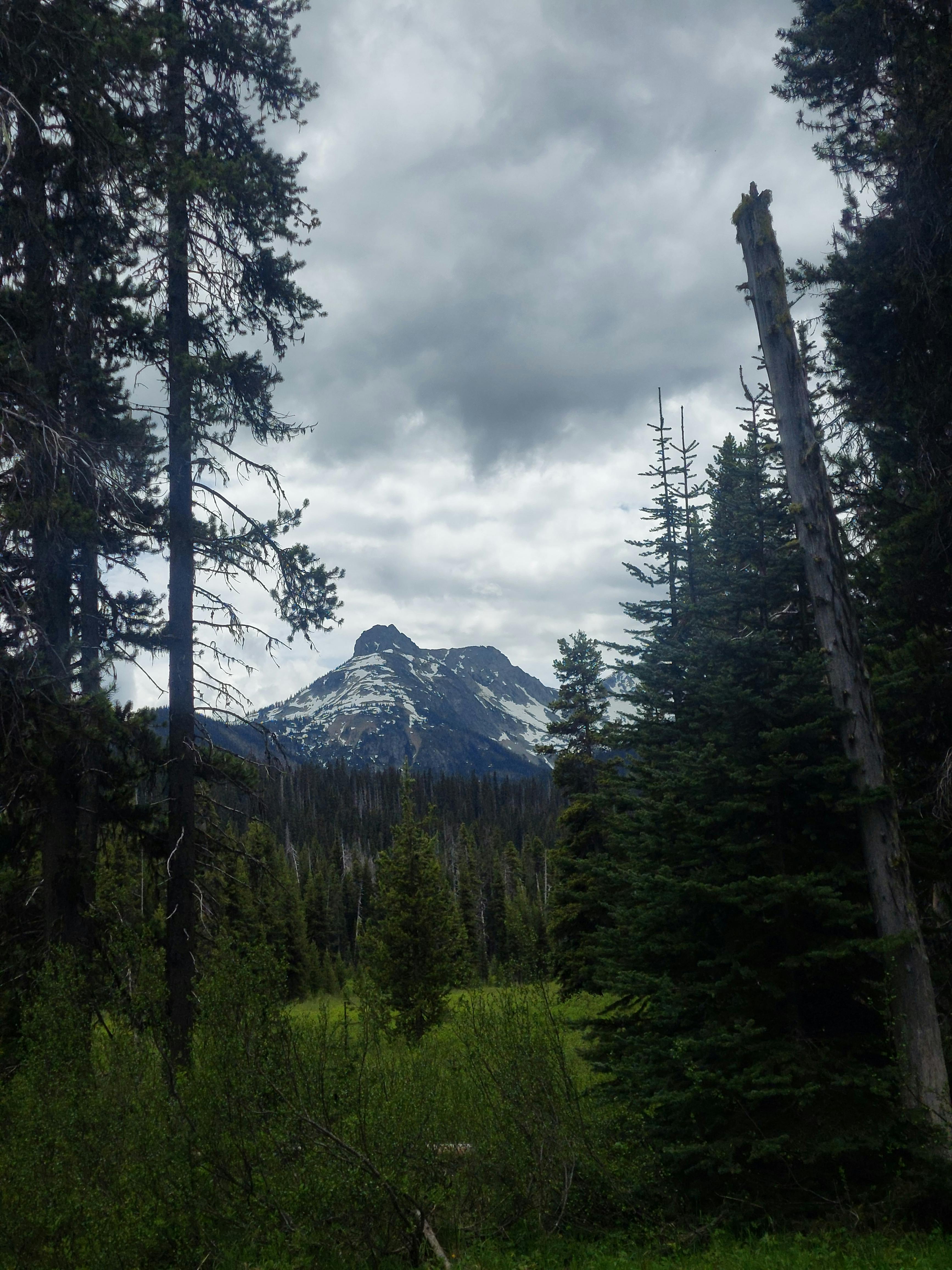
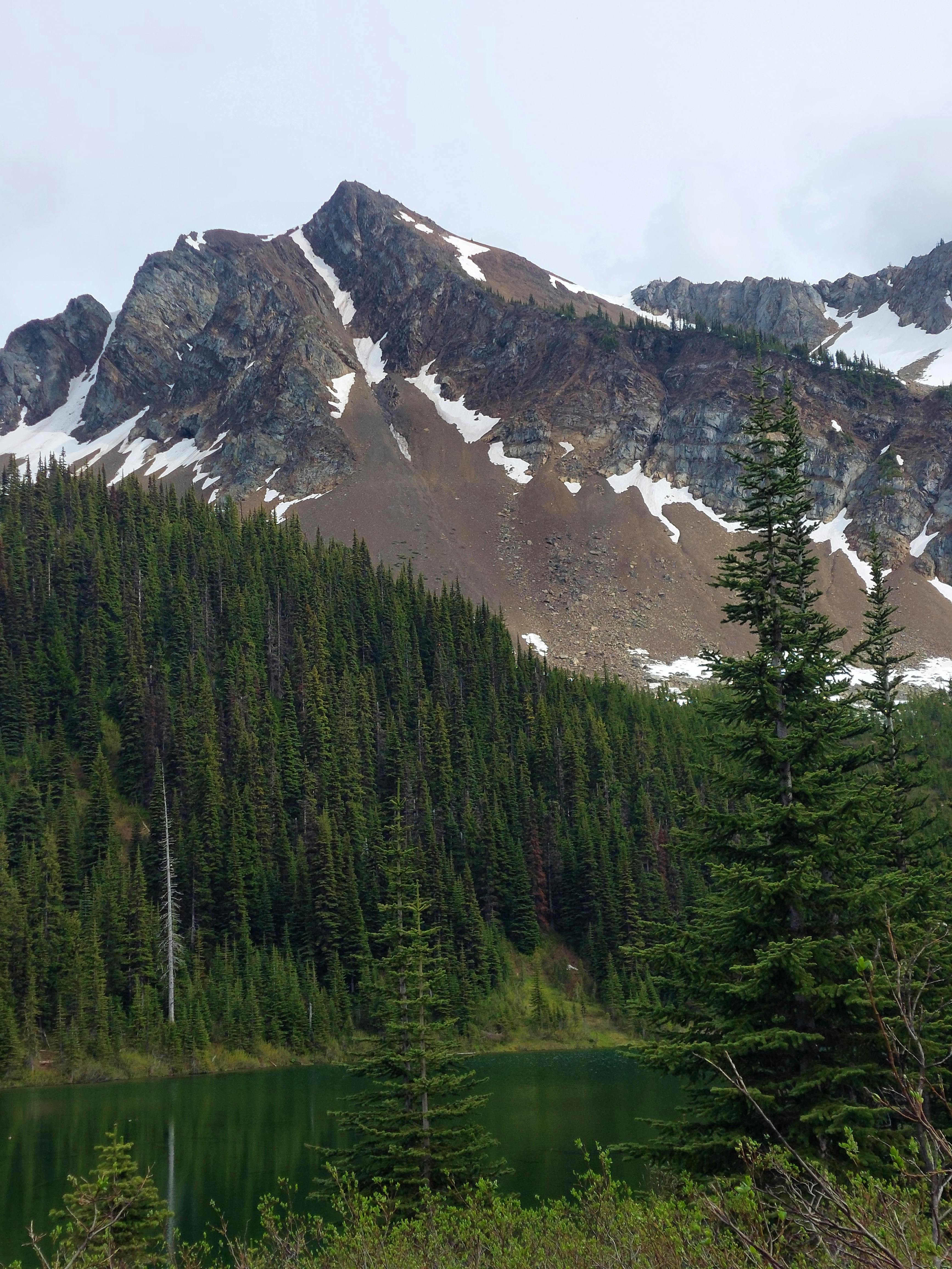
The Whatcom trail climbed up until I was rewarded with a gorgeous view: Punchbowl Lake and the ridgeline between Snazzy and Snass mountains, still holding some snow from the winter, with a thin thread of waterfalls plunging down the far side of the valley. I hadn’t known this until this trek but I was definitely a views and destination hiker, and the sight lifted my spirits. While the whole hike had made me think of Middle Earth, like I was a hobbit tramping through the forests towards the Brandywine River, this part made me think of Bilbo: “I want to see mountains again, Gandalf, mountains!”
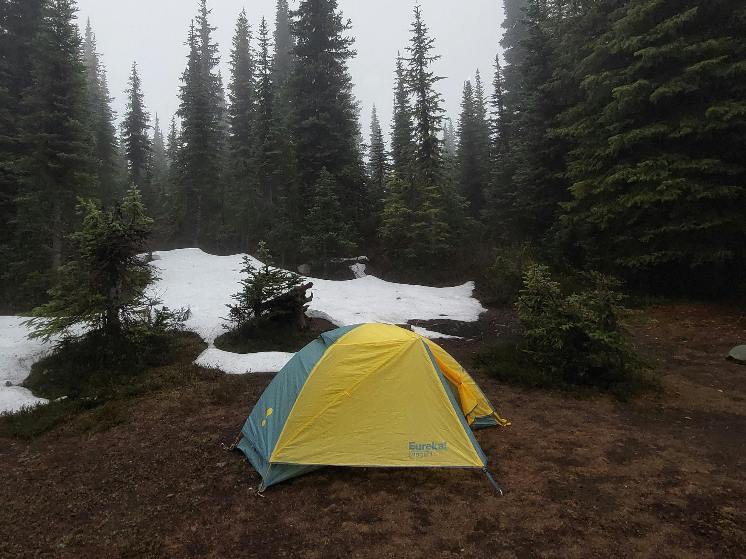
I gained back all the elevation I’d lost in the day in four kilometres until Punchbowl Pass, where I could see the trail snaking off towards Snass, and then descended until I saw a trail junction: the promised Punchbowl campsite.
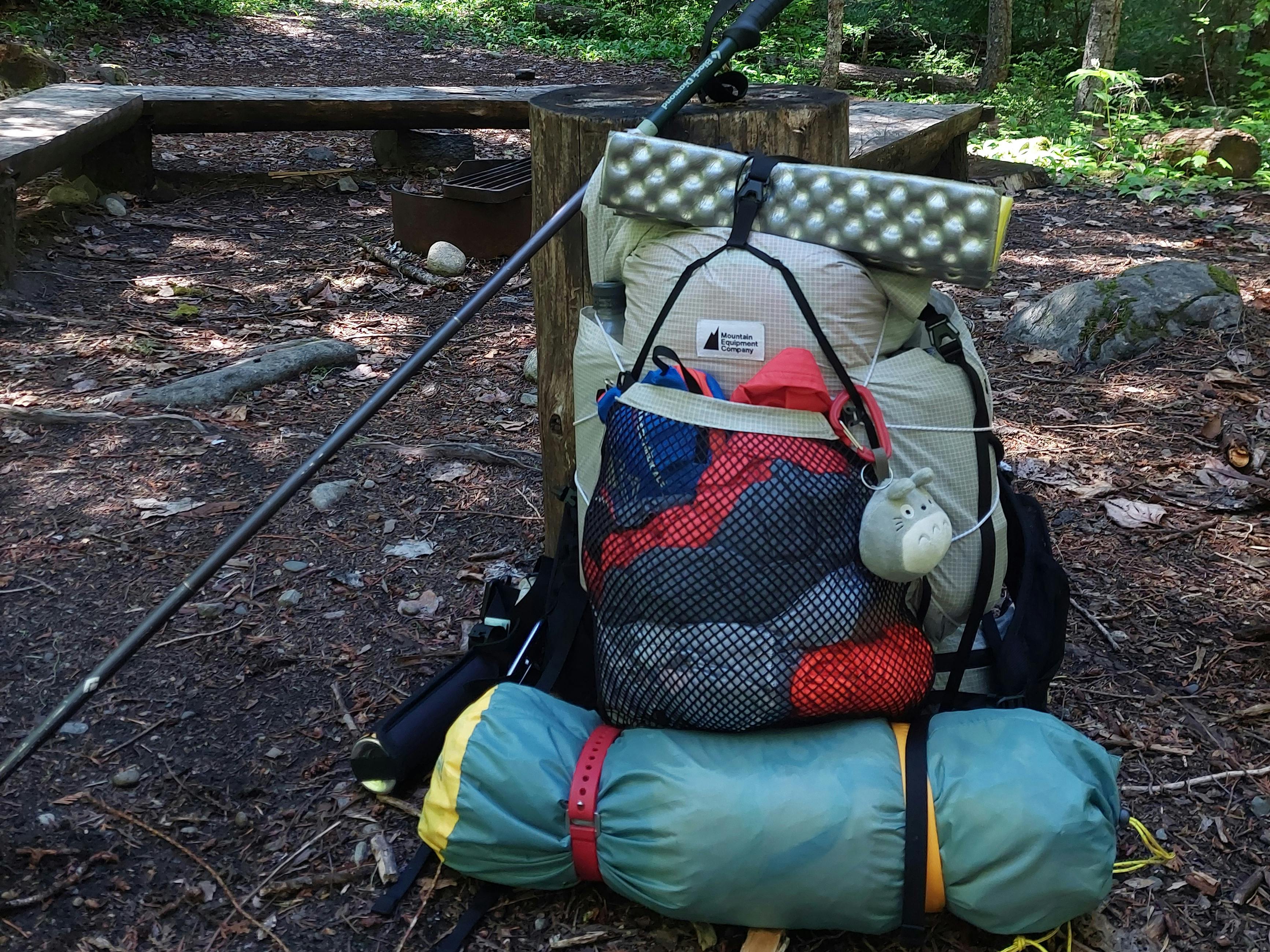
I made dinner and had tea and then got ready for bed. Eating, setting up my bedraggled tent and then trying to rig up my bear hang took me about an hour. I don’t think my bear cache was too great, honestly. I knew it was supposed to be 12ft high, but how was I supposed to get 12 feet in the air myself? I attempted to climb both tree anchors and loop my line around the branches but once I got my bag rigged up and in the air it didn’t seem like it was high enough. MEC had taken my life savings for the bear-proof bag so I hoped it would be enough.
Once again I’d thought that maybe I could read on my phone, since it was only 7pm, but I was out like a light once I crawled into my sleeping bag. I woke up around 2am to the sound of more rain and then spent a delightful hour thinking about the two hikers in Banff who were killed in their tent last year by a grizzly. These thoughts were not conducive towards getting back to sleep.
Day Three
I woke up again at around 6am to the continuous rain. By around 7am I was brave enough to poke my head outside to see a thick fog had settled in and it was still dripping rain.
This crushed my Snass dreams. I didn’t want to go scrambling on wet rocks with no visibility and possibly cross a water-saturated snow patch, which would slide off the mountain with me on it. Since I’d given myself the gift of tackling all the heavy elevation yesterday, all I needed to do was have my coffee, pack up my soaked things and hike out to the car.
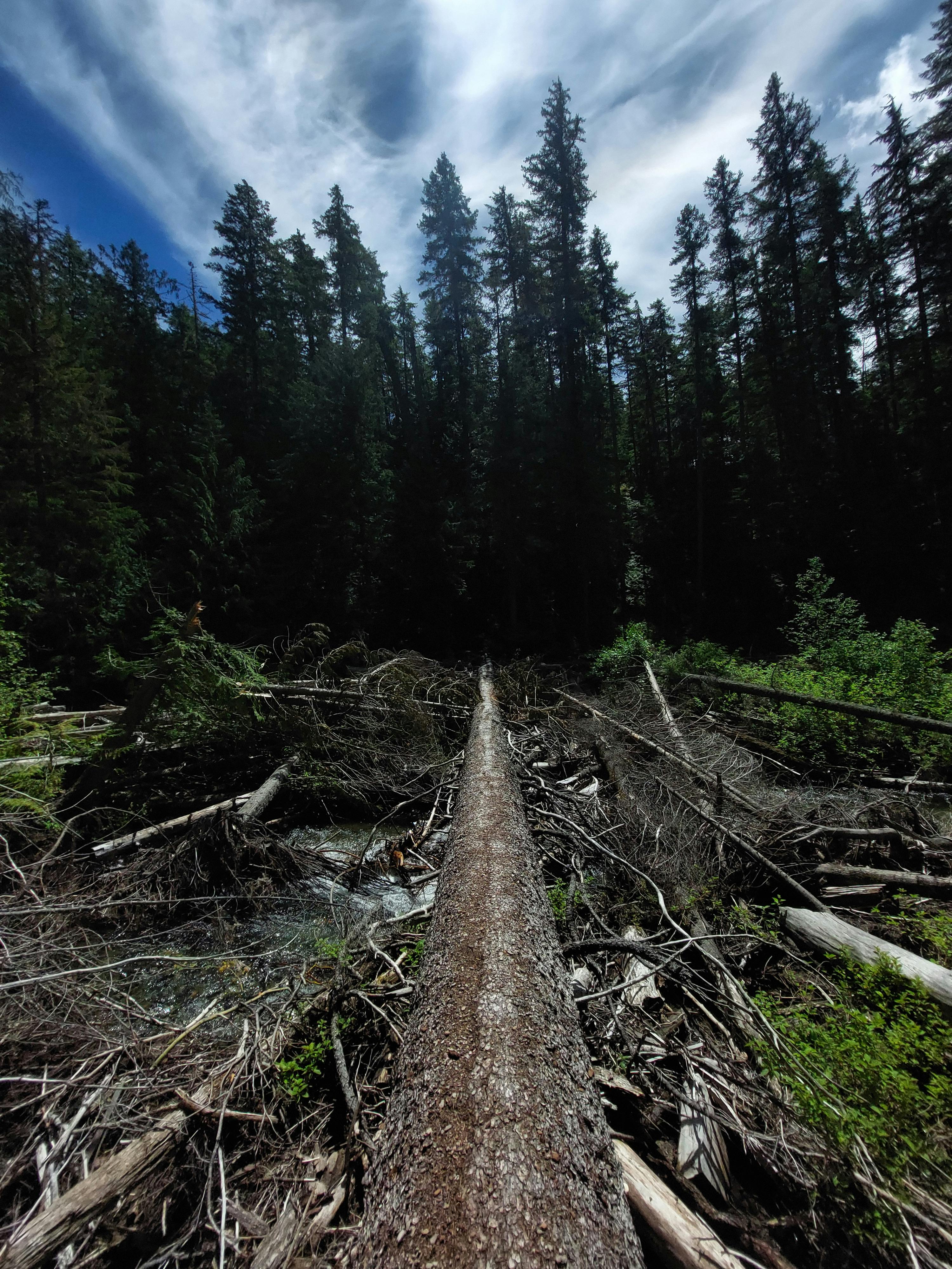
The hike down felt longer than it was, because it was a fairly steep descent. I ended up jogging down most of it out of necessity and hurtled by gaps in the forest that could have been a beautiful view but were now just grey fog. There was one major deadfall, a huge tree that had taken out the trail, and I had to climb on top of it and pull out the GPS to figure out where I was supposed to go; all around me was an impenetrable blank green wall of alder. Eventually I managed to get through it and managed to take a slightly hysterical wet photo of the situation, which does not properly capture how large the tree was nor how thoroughly it obliterated the trail.
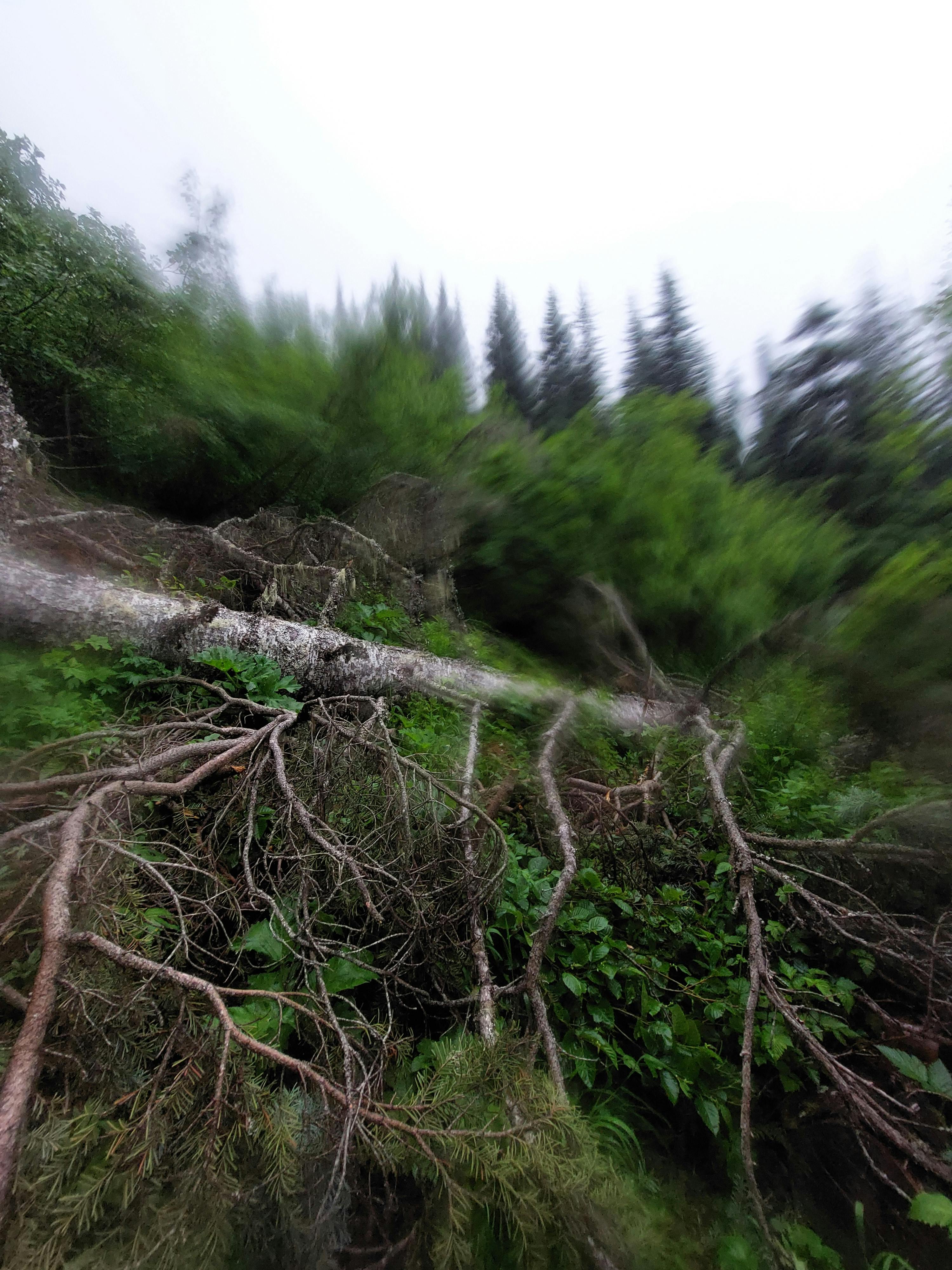
There were so many downed trees along the way that I started wondering why, but thinking back on the past decade, it was obvious: looper moth, heat dome, atmospheric river.
Honestly, as much as I was trying not to be, I was grumpy and eager to get back to the car, especially since I was once again soaking wet and covered in dirt. The hike had largely been a pointless ramble through the what looked like the same stretch of woods interspersed with getting swarmed by biting flies and trying to keep my feet dry crossing a variety of muddy surfaces. I'd been hoping to slow down and feel present, to connect with nature, maybe have a realization or two, and instead mostly I was thinking about how nice it would be to be dry again.
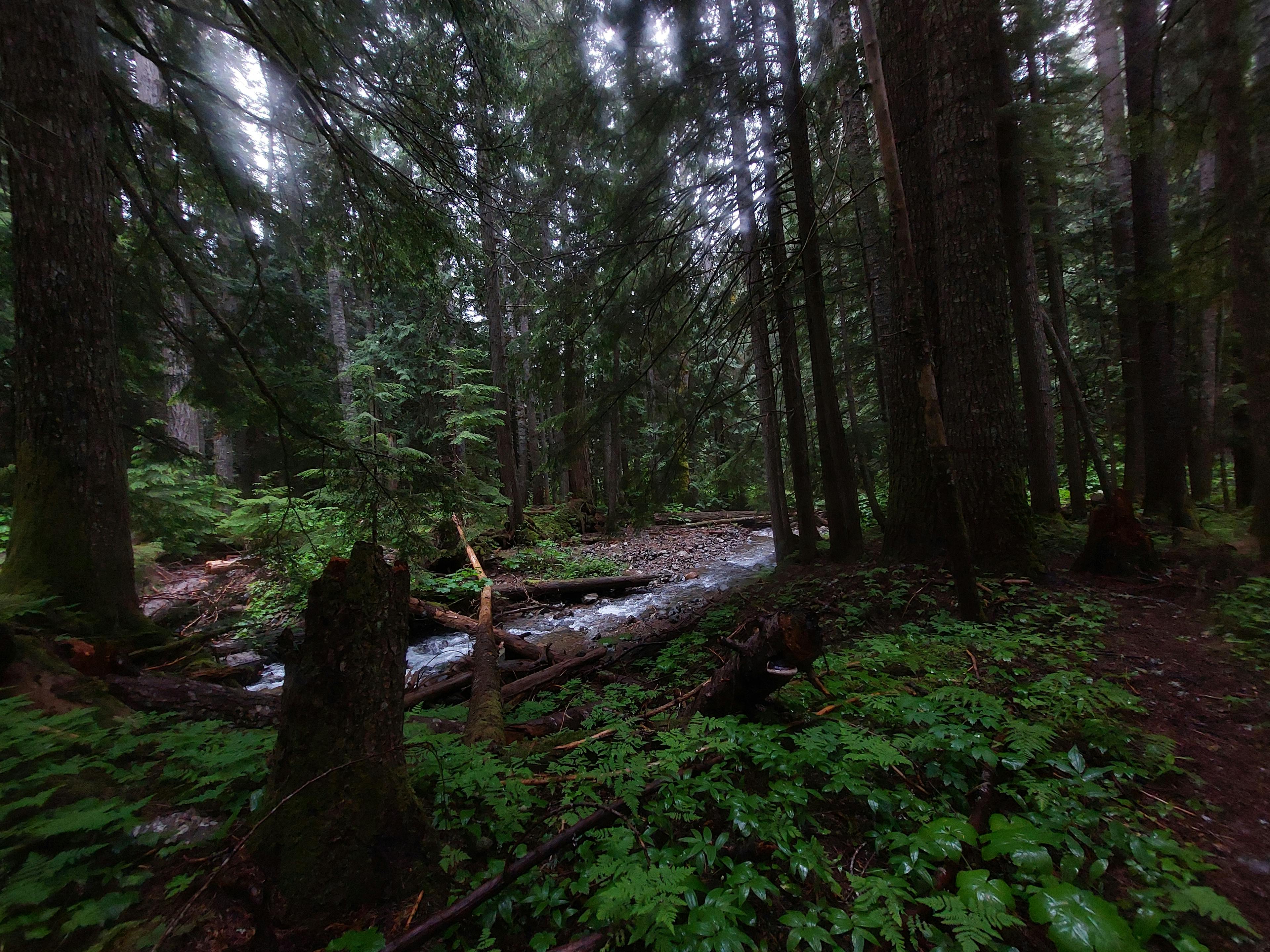
Once I’d made it back to the junction with Dewdney the trail flattened back out and eased into the valley bottom. This looked more like the forests I’d grown up playing in, the ravine beside my elementary school and the woods of Minnekhada near Maple Ridge. As compared to the nervous young second-growth forests along the ridgeline, these were old and stately; or as Robert Frost would have them, lovely, dark and deep.
This last stretch of forest weirdly saved the trail for me; I ambled along enjoying the old cedars, the nursery trees, the thick ferns and moss along the forest floor. Maybe Dewdney wasn't such a bad guy after all. I could forgive him for that Tulameen River crossing.
I’d planned the hike so I’d descend the final stretch right into the parking lot, and I stepped out of the forest blinking the green out of my eyes, right to where I’d left my car.
I don't know what I'd review this hike on a website. On one hand, it was kind of terrible. Back in art school they were always on about what was art; art was apparently something that made you feel something (this was used to justify modern art, which by and large is also terrible). This hike definitely made me feel something. Good things, even. All in all, as my first solo backpacking trip, I'm happy I did it, and I had fun. Five stars.